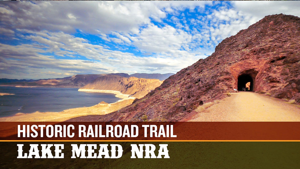
Lake Mead NRA: Owl Canyon Trail Loop
- Jason Evers

- Feb 11, 2021
- 4 min read
Updated: Sep 4, 2025
The MAP

"In this guide, I'll be sharing the method of turning this short 2.2 mile out-and-back into an enjoyable 4-mile loop."

If you've ever hiked the Owl Canyon Trail at Lake Mead NRA and wished there was more to it, here's a quick guide to make it a little longer and add some variety to your trek (in case you're sick of only seeing those incredible slots!). In this guide, I'll be sharing the method of turning this short 2.2 mile out-and-back into an enjoyable 4-mile loop.
Always remember to bring more water than you'll anticipate needing when hiking in the desert, share your route with someone else if heading out alone, and always practice #leavenotrace principles while enjoying our outdoor spaces.
Included in this guide:
The Walkthrough


Above, you'll find a map and directions to the trailhead via Google Maps. Please check the Lake Mead Website for entry fees and times. This is a scenic location with an information kiosk, covered picnic tables, and a single vault toilet (ADA Accessible - however, the trail is not). For the purposes of this guide, please reference the map at the top of this page. Let's get to it...
The trail starts to the right of the "Owl Canyon" sign, the only marker for the trail (Fig. 01). You will be greeted immediately by the steepest section of the hike. The trail here is covered in loose soil, gravel and rocks, so be careful and take your time as you make your way down.
Once you reach the bottom of the incline, you'll be greeted by a large wash. There are lots of use and wildlife trails to your right - follow the first ones to make your way to the shoreline if you're up for some exploration and birdwatching. Otherwise, stay to your left / straight ahead and make your way to the slot canyon that gives Owl Canyon it's name. Stick to the traditional route, winding your way through the slots until you pass through the double culverts that cut underneath the River Mountain Loop Trail (Fig. 02). After passing through either of these and leaving the slots, start looking to your right for a trail that has been lined with rocks (Figs. 03 & 04).


Now that you've reached the River Mountain Trail, you'll be greeted by a spectacular top-down view of Owl Canyon with the waters of Lake Mead finally making an appearance in the distance (Fig. 05). Watch for cyclists on this paved trail - sticking to the right here is your best bet since riders tend to ride the smoother surface on your left (Fig. 06).
You'll follow this paved section for almost 0.5 mile - keep an eye for the path that will take you off of the River Mountain Loop Trail on your right (Fig. 07). If you're recording your route using the AllTrails app, an off-route notification is perfect for letting you know if you've passed up the entrance.
This trail will eventually disappear, forcing you into a wash. Keep heading downhill (to your right) and you'll make your way to the fourth and final culvert. Here you'll pass back under Lakeshore Road for a final time and be rewarded with a small slot canyon. There is a small shelf you must lift yourself down - it's more of a small slide / hop than anything and is fairly easy. However, there is a strange structure in the way - not sure what this is or what the intent was (Fig. 08). Update: this structure was washed away in Winter 2021 due to flash flooding. You'll still find pieces of it along the trail. The way down is a little more difficult, as the gravel has been washed away - expect a fairly easy Class 3 scramble and be careful getting down. Poe and I manage it on our own.


The slot becomes a wash and finally opens into flatlands. Make a right once you reach the Shoreline Trail for an incredible view of The Pillars (Fig. 09) - the trail will take you next to two of them! Follow this wide, flat path for approximately 1.0 miles where you'll eventually rejoin the Owl Canyon Trail. Look for further opportunities to explore on your left (north) as you travel - there are numerous spur trails along the way. Just remember to conserve your strength for the last climb back to the parking lot!
I hope you found this mini-guide helpful! Please shoot me a message or contact me if you have any questions. And if you happen to know the story behind the strange structure along the trail, I'd really love to know!
Photos 1, 3, 5 courtesy of Curt Nova
Not sure what to do with this GPX file? Here's how to upload using AllTrails. HINT: you must use a browser to upload maps, not the app.


Comments